
Langtang region is a popular destination for climbing snow peaks and spectacular panoramic views of mountains in Nepal and Tibet. Easy access to the region and availability of several snow peaks scattered around for acclimatization make this region an ideal destination for novice as well as experienced climbers. Naya Kanga is an attractive peak rising to the west of the Ganja La pass (5,122m/16,800ft) . Ascending to Ganja La and the summit of Naya Kanga offer the spectacular panoramic views of mountains in Nepal and Tibet including Langshisa Ri (6,370m/20,894ft), Pemthang Ri (6,836m/22,422ft), Shisapangma (8,046m/27,749ft), Langtang Lirung (7,425m/24,354ft), Pemthang Kapro Ri (6,830m/22,402ft) and Langtang II (6,571m/21,553ft). The normal route of ascent to Naya Kanga is via the north - east ridge over a line on ice and snow. We follow the route of Langtang trek to Kyangjin (3,749m/12,297ft) for the ascent of Naya Kanga. To the north above Kangjin, there are several hills that provide both the magnificent views and acclimatization. Northeast of Kyangjin Ri (4,700m/15,416ft), there are two peaks; Yala Peak (5,500m/18,040ft) and Tsergo Peak (5,749m/18,857ft) that provide good climbing for acclimatization.
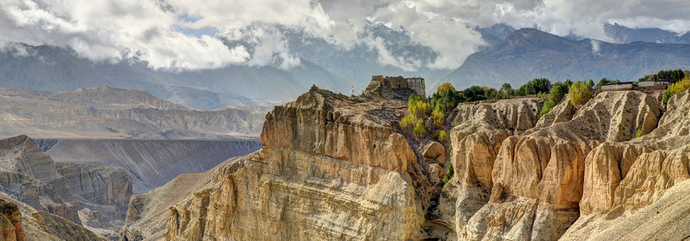
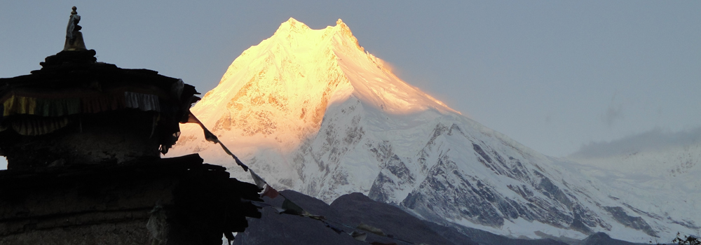

 Nepal having 1310 magnificent pinnacles and peaks over 6,000 meters offers joy of mountaineering which can be combined with the pleasure of trekking. Peak Endeavour Nepal Trekking & Expd organizes peak climbing on all the major trekking peaks in Nepal under the expert management of Peak Climbing In Nepal Experienced Guides. We arrange climbing on all the trekking peaks opened by Nepal Mountaineering Association. Mountaineering beginners can enjoy trekking with a combination of small peak climbing Langtang, Everest & Annapurna regions.
 Hiunchuli lies in the Annapurna range and it is connected to Annapurna South. Discovered by Col. Jimmy Roberts, it is one of the three major trekking peaks within the "Annapurna Sancturary", to be named by Roberts. The mountains of this area are considered the sacred by the Gurungs who inhabit the region. The other two peaks within the sanctuary are Tharpu Chuli (Tent Peak) and Singu Chuli (Fluted Peak). Hiunchuli was first summited by an American Peace Corps Expedition under the leadership of Craig Anderson in October 1971. Although it is easy to reach the mountain and the popularity of the Annapurna Sancutary with trekkers and climbers, the actual ascent of Hinuchuli is considered one of the most difficult among the trekking peaks.
 Singu Chuli, an attractive mountain for climbing, is also known as Fluted Peak. The mountain can be seen from Annapurna South base camp but the better shape of the mountain with pointed ridge of snow and ice is seen from the moraines above the lodges. The mountain can be approached from several routes: North-East Face, South Ridge, South Face & West Face.
 Mera peak is considered one of the major and popular trekking peaks in Nepal. The Peak itself rises to the south of Everest. The ascent of the peak is technically straightforward, however, the heavy snow and the maze of crevasses can make the way longer to the summit. Besides the charming of climbing Mera Peak, the trek to its base camp from Lukla is rewarding for experiencing little-visited and yet unspoilt region of Nepal with densely forested hill sides. There are several approaches to the base camp besides the easy and normal route which is mentioned below. The routes crossing Amphu Labtsa (5,780m) and the Mingbo La (5,871m) are quite adventurous and rewarding for spectacular scenery but none of them are easy.
 The North Ridge is approached from Monjo on the trail to Namche Bazaar. From base camp ascend steep grass and scree and finally a ramp leading to the ridge proper.
 These peaks are part of the Manang Himal, which are quite rightly included in the larger Damodar Himal, the eastern limit of which runs south from Chako and Peak 6687 in a north-to-south direction along the Hunlung Khola, Nar Khola and Phu Khola. To the south it is bounded by the Marsyangdi Khola and the Mesokanta La. To the west its limit is the Kali Gandaki and to the north the Parchekya La (5,447m/17870ft). There exists considerable confusion with regard to the name and location of the Chulu peaks and what summit actually constitutes Chulu West and Chulu East, since it is soon becomes apparent to anyone that has climbed in the range that several other summits close by, which are actually part of the Chulu massif, are not indicated on present maps of the area. For the sake of clarification, four summits can be included in the Chulu group, two of which are possible on the permit for Chulu West and two on the Chulu East permit. What is apparent is that the available trekking map is highly misleading.
 For those who love Nepal, its landscape and people, here is a little known trekking peak leading to a wonderful viewpoint facing the Annapurna Great Barrier. Chulu Massif rises north of the Marshyangdi Khola in the Manang region and form part of the Manang Himal, which is quite rightly included in the larger Damodar Himal. This remote upland area lies to the north of and in a rain shadow formed by the main Annapurna Himal. Huge glacial moraines abound etched deeply by wind erosion into fantastic pillars.
 This is the most popular trekking peak in Nepal. From Dingboche the mountain is seen as an island in a sea of ice. The summit is interesting and attractive with a highly glaciated west face rising from the Lhotse Glacier.The mountain itself is the extension of the South Ridge of Lhotse Shar seperated by a small col. The ridge rising to the south from this point leads to the summit of Island Peak. The extension of this ridge descending south-west is the part of the normal route of ascent and leads to the South Summit. Imja Tse not only provides an enjoyable climb but also provides some of the most spectacular scenery of Himalayas in the Khumbu region. Seen from the summit the giant mountains, Nuptse (7,879m), Lhotse (8,501m), Lhotse Middle Peak (8,410m) and Lhotse Shar (8,383m) make a semi circle in the north. The views of Makalu (8475m) in the east, Baruntse and Amadablam in the south add more charm for climbing Island Peak.
 The peak, which lies due south of the Tesi Lapcha, is unnamed on the Schneider Rolwaling Himal map, but is given a spot height of 6,273 metres (20,581ft). The Mandala Lamasangu to Everest map calls the peak Parchoma, which is quite possibly a spelling mistake. Both Shipton's and Gregory's expedition surveys gave the peak an altitude close to 6,318 metres (20,700ft). Seen from the pass the mountain is an attractive but straightforward snow peak with a Tesi Lapcha in about 25 days or so
 There are two distinct summits to Lobuje Peak - Lobuje East (6,119m/20,070ft) and Lobuje West (6,145m/20,161ft). Although they are connected by a continuous ridge there is a sharp gap and a considerable distance between them. Lobuje is an attractive summit, offering a variety of existing routes and a wide scope for new lines. Seen from near Pheriche, the dark triangle of its rocky East Face rises above the moraines of the Khumbu Glacier to an icy skyline. This skyline forms the South Ridge, the junction of the East Face with the glaciated South-West Face and the line of the normal route of ascent. This in turn leads to the summit ridge running north-west from the top of East Face through several small summits to the East Peak.
 Situated south of Na in the upper Rolwaling area, Ramdung, also called Ramdung Go, is one of acluster of peaks around the Yalung La (5,310m/17,421ft), a pass giving access to the upper Rolwaling from the south, via the Khare Khola. The peaks in the area were first explored by Scottish Himalayan expedition, led by Bill Murray in 1952, when three of the peaks near the pass, Yalung Ri (5,630m/18,471ft), Chhugyima Go (6,259m/20,534ft), and Ramdung were climbed. In 1955 the peak had its second ascent by members of the Merseyside expedition. Since then Ramdung has been climbed numerous times is an ideal summit for groups wanting to trek and climb in the still little visited Rolwaling Himal area.
 Pisang Peak rises above from Pisang village and yak pastures in a uniform slope of ice and snow to the final summit pyramid. Pisang peak is considered one of the easy climbing peaks among the trekking peaks in Nepal. To reach the base camp from Pisang village, the path ascends through sparse wood and pasture to a Kharka at 4,380 meters (14,366ft) which is considered the best place for setting up the base camp. High Camp is set up at 5,400 meters (17,715ft) climbing to a shoulder on the South-West Ridge. There will be snow at the high camp from the end of November to the end of March. The well defined ridge leads to the final snow slop which is quite steep but not difficult to reach the summit. Descent is made on the same route.
 Locally known as Tarphu Chuli, Tent Peak is situated in the heart of Annapurna Sanctuary and is among the few snow-clad summits at this height range in Nepal. This peak offers an ideal opportunity for those who want to summit a Himalayan peak, but who may otherwise be hesitant to try a higher peak as a Himalayan debut. Besides providing an interesting climb combining glacier travel, face climbing and tip-toeing on knife ridges, a climb on this mountain offers an unparalleled view of the entire Annapurna Sanctuary a breathtaking circle of hanging glaciers and moraines surrounded by some of the highest peaks on earth. The normal route follows the North-West Ridge to the summit although the mountain has been climbed via the South-East Ridge as well as South-West Face.
 Formerly called Mehra Peak or simply Mehra, this attractive mountain rises to the north of the Kongma La above the Khumbu glacier opposite Lobuje, and is one of several small summits, including Pokalde, that make up the long South-West Ridge of Nuptse, between the Khumbu and Nuptse Glaciers. Seen from Gorak Shep, the summit has a diamond shaped hanging glacier above a steeply inclined rock wall that makes up the mountain's North Face, which is in turn slashed by a diagonal ice ramp leading to the lower edge of the glacier.
 This mountain was first climbed in 1953 by a route from the Kongma La along its North-ridge. Despite its relatively low altitude the mountain's first successful climbers were giants of the mountaineering world, a fact that is true of many of the Trekking peaks. Phokalde is an insignificant-looking mountain when seen from Periche, from where it appears as a rocky ridge dominated by the vast bulk of Nuptse. Seen from the Lobuje or Gorak Shep the peak looks more interesting rising to the south of the Kongma La (5,535m/18,159ft), an infrequently traversed pass that leads into the Chhukhung Valley. The northern side of the mountain has a small hanging glacier that is best reached along the ridge rising from the Kongma La. By and large the rock on the mountain is poor, although it does offers some interesting scrambling on the well-defined ridges. The summit provides a good viewpoint and from that perspective is a fine little peak.
 Less than fifteen miles north of Pokhara, as the crow flies, this mountain is the most southerly of the Annapurna range. From some viewpoints it seems little more than an outlier on the south-west flank of Machhapuchhare. Mardi Himal is the lowest and perhaps least climbed or visited of the trekking peaks. Once again it was Col. Jimmy Roberts who, with two Sherpas, climbed to the summit by a route on its East Flank in 1961. The normal route of ascent reaches a col from a glaciated amphitheatre that rises above a hidden plateau; the 'Other Sanctuary', as Roberts calls it. Although another route has been made on the south-West Face, Roberts' route is the only recorded line and the one used on most subsequent ascents.


